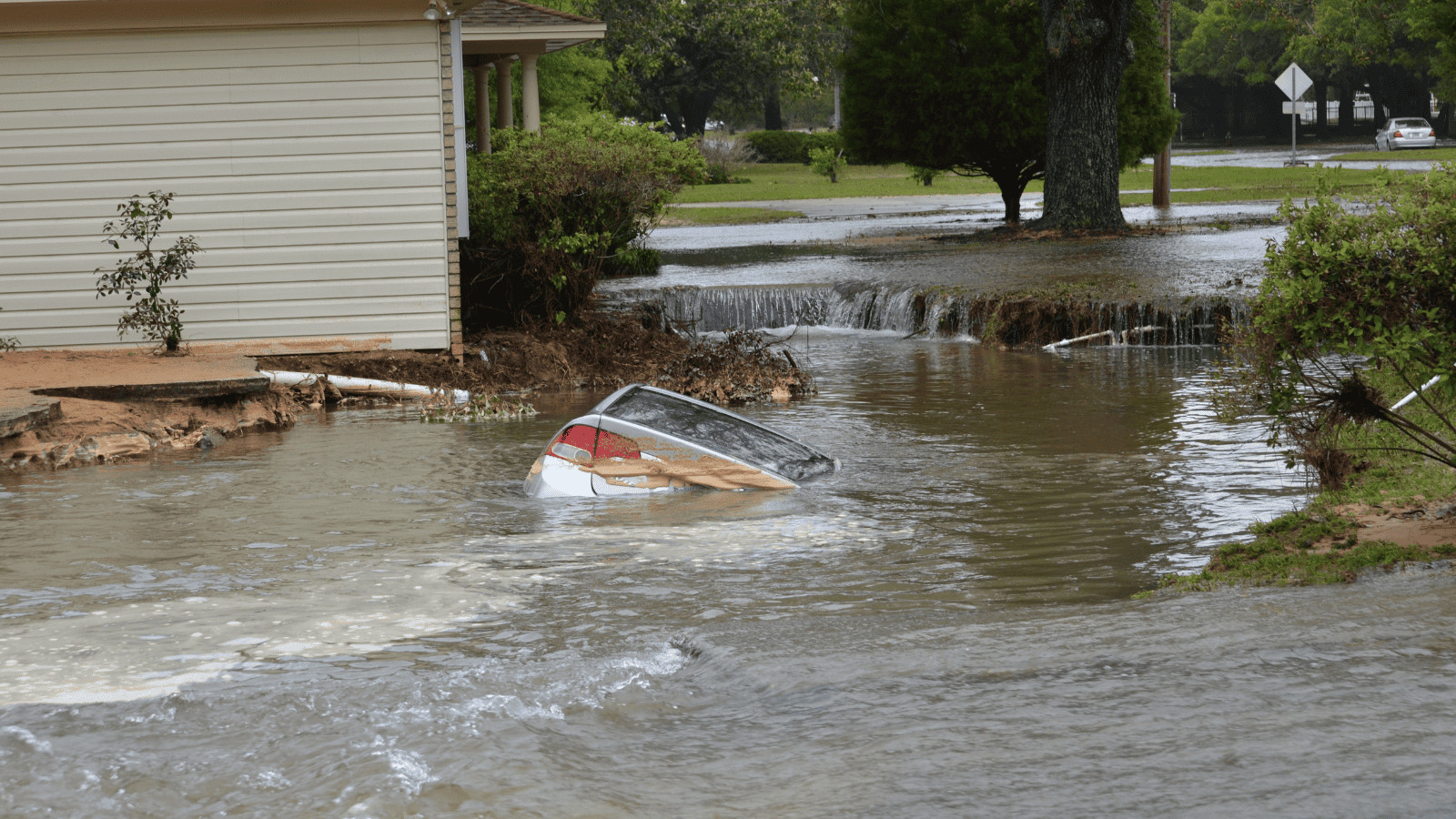
Vermont has now joined New York with disastrous flash floods surging across the state.

The Caribbean for Less Than You Think
Up to 65% off + a resort credit + a free night at select Sandals resorts. 8 islands. 17 resorts. All-inclusive everything. See the deals →
Due to heavy rainfall, rivers have overflowed, causing damaged roads, and residents being stranded in towns hit hardest by the storm, including Ludlow.
Torrential rains across parts of New England will be “slow to subside and dissipate” as “significant flooding remains possible,” the National Weather Service said. Flood watches are expected to remain in effect for much of the region throughout Tuesday.
Vermont Gov. Phill Scott compared the downpour to Tropical Storm Irene, the historic 2011 storm that destroyed bridges, homes, and roads. The Governor has declared a state of emergency as the severe weather continues to wreak havoc.
More than 8,000 utility customers were without power in Vermont early Tuesday morning, according to an online tracker.
Downtown Montpelier, the capital of Vermont, was flooded overnight, prompting officials to close the downtown section of the city until noon Tuesday. Footage and images are now emerging from the capital, showing the extent of the flooding so far.
#BREAKING: Flooding hits #Montpelier as #Vermont sees flooding levels not seen since Hurricane Irene in 2011.#VTwx
— Fast News Network (@fastnewsnet) July 11, 2023
As of 9 pm on Monday 10th, July, there have been more than 50 rescues by swift-water teams in Vermont, according to state emergency management officials said. Experts warning the dangers of this flood will only grow more severe as the rain continues.
With the U.S. Military Academy West Point recording 6.96 inches of rain in three hours — a 1-in-1,000-year rain event for the region, it is strongly advised to avoid any travel to Vermont or its surrounding areas.